Winterlude is our 1985 Passport 37 sailboat … with a 5 1/2 foot draft and a usual cruising speed of 4.5 – 5 knots. In preparation for cruising the Exumas/Bahamas, we searched everywhere for specific information on what other slower cruisers did when crossing the stream and routing to the Bahamas. Although everyone touts it as being an easy day run across the gulf stream, for those of us slower boats, it’s not exactly that simple. It’s a long day across the gulf stream to Bimini, Gun Cay, Cat Cay or South Riding Rocks depending on where you choose to cross. Then another fairly long day across the Great Bahamas Bank to the Northwest Channel with nowhere to hide if the weather turns against you, yet another day sail from the Northwest Channel to Nassau or the Berry Islands/Chub Cay or Frazier Hog Cay … and you’re still not there yet, but you ARE within 38 miles of the Exuma Cays, the jewel of the Bahamas.
Waypoints and routes are provided for information only and are not to be used for navigation. Several of the routes, require eyeball navigation to dodge coral heads that might be within a few feet of the surface. We are not responsible if you use these waypoints.
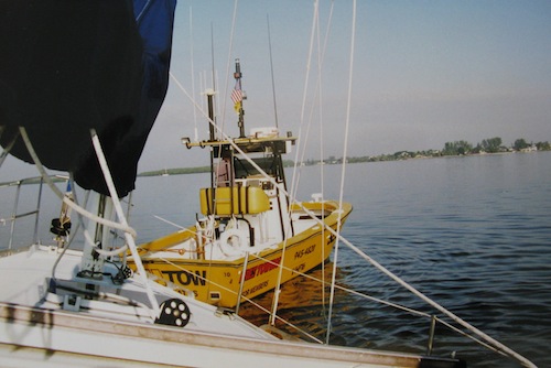
- Marathon to Rodriguez Key (close to Key Largo). Anchored in 6-7’ in thin grass, behind a large NOAA yellow weather buoy in the middle of the anchorage.
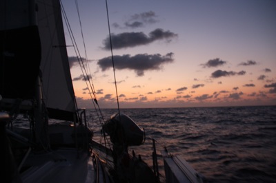
- Rodriguez Key to Bimini. Departed Rodriguez at 2:30 AM in the pitch dark. Wind was 14-16 knots from 150 degrees (forecast was 8-11 knots) and we had 1 reef in the mainsail. Out over the reef in the dark was scary. Here are the w/p we used:
25 06.010 N 080 22.645 W
25 05.283 N 080 18.375 W
25 05.283 N 080 17.367 W
-

Blue Water Marina, Bimini Arrival at Bimini. Arrived at 14:30 at the waypoint just outside Bimini. Sailed the entire way, mostly 7-9 knots of wind. With the current we hit 8.9 knots of speed at times which for us is extraordinary! This w/p is almost on top of the Bimini outer markers so keep an eye out. 25 42.617 N 079 18.492 W.
The entry to Bimini has outer markers only and from there to the inside channel is unmarked because of the constantly shifting sandbars. This entry requires reading the water and visual navigation. Winds from the southeast caused breaking waves in the short but twisting channel. We came in at high tide, followed the narrow ribbon of deeper blue water to starboard and did not bump but other boats did. Luckily it’s white sand.
We stayed at the Blue Water Marina at 25 43.509N 079 17.846 W. They instructed us to take any slip, but we didn’t know which docks! It’s the last two docks before the gap to the Big Game Resort down the channel. We had 7’ of water in the slip.
-
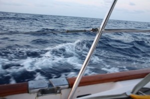
Gulf Stream Crossing Crossing the Great Bahama Bank. Left Bimini and cleared the channel on a rising tide.
25 38.725 N 079 19.505 W headed to Triangle Rocks
25 34.260 N 079 13.017 W
25 34.285 N 079 12.766 W – turned to cross the banks
We followed the “preferred route” to the Northwest Channel Light in the Explorer Chartbook and had no problem despite our depth sounder taking a short vacation right in the trickiest part where the chart showed 5’ at one spot. These charts are the best we’ve ever used. Good job Explorer!
- Anchored on the banks at 7:30 just at sunset, 10 miles short of the Northwest Channel Light at 25 29.292 N 078 19.762. 14 feet of water over sand with sparse grass. Good holding. Very little wind, a bit lumpy but slept good despite being concerned something would hit us. We awoke to a different boat motion which alarmed us, but with the light winds, the boat was affected more by current than wind. Wind was over the stern quarter.
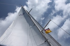 Passed the NW Channel Light at 25 28.2 N 078 09.6 W, cleared the channel and turned to a 135 degree heading to West Bay, New Providence w/p 25 01.1 N
077 35.00 W. Anchored outside, total mileage 51 miles, mostly in inky deep blue water. Rolly anchorage.
- Unexpectedly we were called back to the US, so we sailed from West Bay, New Providence to Albany Marina on the southwest end of New Providence.
- Departing Albany Marina to the Exumas, specifically Highbourne Cay, incoming tide all day.
24 58.996 N 077 30.715 W – 15’ clear water with coral heads
24 58.064 N 077 30.433 W – course change to 145 degrees at 5.2 knots
crossing the white bank we saw 11-15 feet of sand/grass, counting starfish
24 50.00 N 077 18.00 W – 9-13 ft, scattered coral heads, doing 5.6 knots
24 45.802N 077 05.771W – coral heads, 17’ deep but I saw a few that might have been within 5-6 feet of the surface, hard to tell in this clear water!
24 44.164 N 077 00.305W
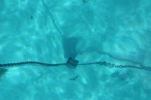
Dropped anchor outside Highbourne Cay, Northern Exumas, with 15 other sailboats – widely spaced, 1 mini cruise ship, 2 mega-yachts and a mega-trawler.



Jan, thanks for posting. We are planning this trip early in 2013.
Seeing that picture of Mark at the helm of his Kanter 52, Vela, alsmot brought tears of happiness to my eyes. You see I have known Mark, more or less causually, since the 1980 s when we both rafted and kayaked rivers in the west for adventure. I bought one of the original sandals that Mark designed and hand made in his home in Paonia, CO. Those sandals evolved into one of the world’s most well known foot gear; and if I might say so, the best ever made I still wear them.But back to tears as no one can turn down an emotional story, especially one with a happy ending. I now sit on my own sail boat, Rhapsody, in the Bahamas writing this. A lot of the reason I am here is because of the chance Mark provided me by inviting me to accompany him and his wife in bringing their boat from the Caribbean Island, Antigua, home to Boston via Bermuda, across that vast wilderness know as the Atlantic Ocean. It was the lessons I learned from Mark and watching the precise manner in which he expertly caressed from her the best performance Vela.Living with two other people, a couple, over the joys, and yes hardships shared across 1800 some miles of mostly open ocean allows a person to know his ship mates better than most opportunities allow. So with tears of happiness I sit here remembering that adventure I had with Mark, wearing his sandals constantly for the last 25 or so years and knowing that if Mark is involved in doing something it will be done with care, precision and joy. Good luck with your new endeavor. And thank you, I will drink that cheap vodka before I ever spray it on clothes!Skip Edwards, Former Vela Crewmember
Are you sure your waypoints are correct ? . Map them on Google Earth and look at the results , Some of them are in the Congo (Africa)
Hi John — I doublechecked the w/p and while I’m never sure they’re correct (that’s why no one should ever blindly use another boat’s w/p’s), I don’t see any that seem to be out of place on Navionics – nothing close to the Congo (Africa). Can you tell me which w/p you noticed so I can triple-check? We’ll be back aboard in the next couple weeks and I’ll look at the GPS track again. Thanks John! Cheers — Jan
[…] after departing at 2:30 AM the prior morning!) and clear in. We crossed from Rodriguez Key … here’s a post with our waypoints all the way to the Exumas as a starting point to plan your adventure. The Blue Water Marina in Bimini was a bit run down, […]