
They said it couldn’t be done. They said don’t even try. Go outside, never never go inside. The New Jersey ICW is winding, narrow and impossibly shallow with ever shifting bottom contours and no way to predict the next trouble spot.
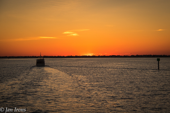
So “they” are all right … and wrong. When we returned to Optimystique in Cape May, we wanted to depart immediately to catch up with our friends on The Great Loop. Unfortunately Mother Nature had other ideas. Blowing 15-25 with 5-7 foot waves (which really means 7-10 foot waves every now and then) was not two days that sounded fun out in the deep blue ocean. Luckily the forecast for the 3rd day was completely calm with waves less than 1 foot. Now that sounds like my kind of outside passage.
Having “Docktails” that evening, one boat that was headed to Maine declared they were leaving in the AM and going inside. That got our attention … going INSIDE? Looper lore says that’s not possible. The popular cruising guide Great Loop Navigation Notes by Alan Lloyd doesn’t even cover the inside route, just assumes no one would be silly enough to consider it.
Knowing that weather might be a challenge (isn’t it always?), I prepared a marker by marker distillation of each recent comment on Active Captain as well as a bunch of data compiled by following the AGLCA (American Great Loop Cruisers Association) forum daily. Unfortunately I only prepared it for the FIRST day of the journey. Since it changes literally hourly, my document will not be accurate when/if you fact a similar decision, but regardless, it’s available as a PDF file if you want to download it as a go by to make your own.
After checking the tides and currents to make sure we’d encounter the shallowest spots at a mid to high tide, we followed m/v Cygnet out of Utsch’s Marina in Cape May, New Jersey on a sunny gorgeous (but very windy) morning in June. Cygnet’s draft is 3’3″ and Optimystique’s draft is 4′. Our plan was that they’d let us know if they saw any real trouble spots….. defined as anywhere we might get stuck!
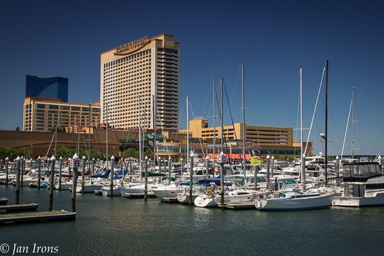
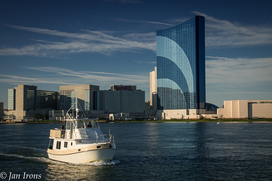
We made it from Cape May to Atlantic City where we stayed at Farley State Marina at the Golden Nugget casino and discovered that gambling has passed us by. Gone are the days of putting my quarter in, pulling the lever and hearing the ching, ching, ching of coins throughout the casino. Instead, we discovered it’s necessary to be technically literate to operate those the machines and the slot tables (Jan’s preference) were $10 minimum – insuring my $20 gambling budget won’t last. But I digress….
The 2nd day we cruised from Atlantic City to Tom’s River NJ and anchored at Silver Cove. Nice quiet anchorage and really nice day cruising behind the barrier islands and New Jersey beach houses all lined up along many of the channels.
Before we could depart Manasquan Inlet, we had to navigate the “chute” i.e. canal that opens into the inlet. This canal is WICKED current so be SURE you’re not going in on an adverse current. We timed it so we were going through with max current with us and it was like a log flume ride… but super important to keep control of the boat so it doesn’t get sideways. We went in doing 6 mph and immediately we were doing 12 mph! Fastest we’ve ever gone on Optimystique. But we had no trouble other than elevated adrenaline!
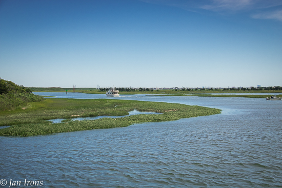
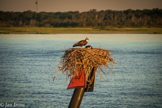
Bottom line: not only did we make it the entire two days inside the NJICW from Cape May to Manasquan Inlet, but we actually ENJOYED it. It wasn’t exactly scenic, but cruising behind sandy beach barrier islands, through Barnegat Bay or the twisty salt grass marshes was pretty once we relaxed enough to enjoy it.
Yes, there were shallow spots – only one did we seriously wonder if we’d be stuck. It was just before Atlantic City and we were almost at low tide. Cygnet called to let us know they were in less than 4′ of water and we could see their prop churning up mud. David thought the track should be slightly right of Cygnet and despite seeing shallower depth soundings than we’ve EVER seen before, we made it through.
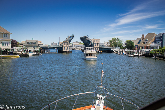
Yes, the NJICW is twisty and much longer than the direct route outside – our first day Cape May to Atlantic City was 52 miles, while outside would have been about 42 miles – but it’s also scenic in a different sort of way. Yes, there are multiple bridges, but only once did we have to wait.
However, we were in position 2 days later to take advantage of a perfectly flat calm cruise out Manasquan Inlet to New York Harbor. Had we waited, we would have still been in Cape May waiting to go outside to Atlantic City!
Some things to know.
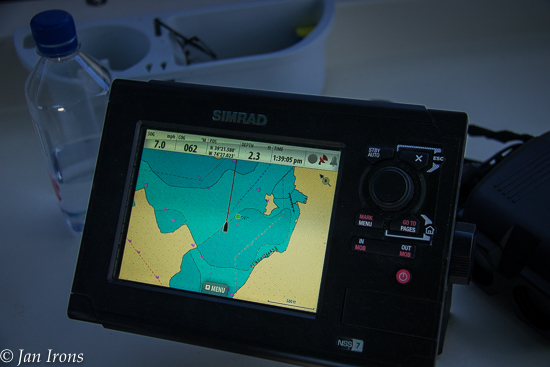
- Try to depart 2-3 hours before high tide and time your cruise to make the shallowest spots on mid to high tide. Keep in mind, much of the NJICW is no wake or speed limit zones, so there’s no way we could run 52 miles and not be at low tide approaching Atlantic City. The shallowest spot we saw was between markers G207 & G209.
- Have the right charts – we had Navionics Plus on our chartplotter and the Maptech New Jersey Coast chartbook which shows both offshore and the ICW. David won’t go anywhere without paper charts & it’s nice to glance at them for the “bigger picture”.
- Make sure your SeaTow and/or Towboat US towing insurance is paid up and in effect. NOTE: if you don’t have it, it takes 24 hours to be effective, so plan ahead!
- If you have Navionics Plus and can enable the sonar bottom contours, we found the extra bottom contours to be mostly accurate which helped when we were unsure which way was deeper.
- Life is all in the timing and the NJICW is no different. Make sure to time such parts as the canal before Manasquan so you have current with you and not against you.
- Relax and enjoy the ride. We thought the currents/tides/shifting sands in the southern Georgia ICW were much worse than the NJICW.
Have you navigated the NJICW lately? Want to update this post so those stuck for weather in Cape May can benefit from your updates? Please leave a comment and share! Cheers! Jan


I tried it once and gave up after 10 miles. Remember to give us a call when you get to the Lockport area. Gary and Judy Coppola (716) 523-1969.
Hello Jan and Dave!!
This is so exciting to read about – I am in awe of your skills. Glad you’re having a grand time and hope to see you when it’s done. Keep up the great story!
Drawing 5′ I guess we won’t be doing it. Although I would love to travel through the neighborhoods I’ve driven so many times.
Re: the chute–we think of going “with” a strong current as pretty risky because you lose steerage. It’s much safer to go against the current–assuming the speed isn’t greater than your boat can handle. We briefly tried to sail the Cape Fear River into the current before realizing that even the substantial wind wasn’t enough to power us against the current.
Glad the adrenaline was the only thing pumping on your way through.