
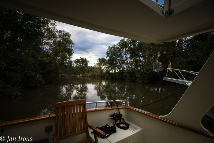
Below Demopolis, the Tombigbee Waterway winds for over 200 miles through virtual wilderness before emerging in the bustling busy port of Mobile, Alabama. There are more challenges along this stretch of the Great Loop than any other part of the Loop so far. Luckily, challenges create lasting memories and we definitely have our share!
Short daylight hours, two locks, no marinas and few anchorages capable of holding more than a couple of boats add to the challenge. We’ll detail the challenges and then share our route and stops in hopes they’ll help someone following in our wake.
The Challenges
Little to no cell service – makes keeping up with weather (and friends) especially challenging when transiting during multiple days of thunderstorms and fog!
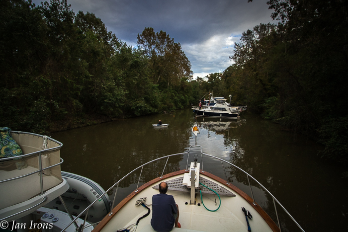
Difficulty to see submerged logs and other debris continually present challenges. An attentive bow watch is critical here, but gets tiring staring at brown water for hours.
The meandering riverway is full of tight turns and tows with barges. AIS has never been more valuable – I’m so glad the tows can see us as well as we can see them. Often we were asked to hold up until a barge gets around a particularly tight hairpin turn before proceeding to pass or meet.
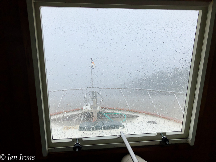
FOG! Late fall which is when most Loopers are transiting the lower Tombigbee Waterway means cool mornings. Cool mornings often mean dense fog which may not burn off until late morning.
This wouldn’t represent a challenge except that the available daylight hours are getting fewer by the minute. Couple that with the Fall Back time change and it’s daylight by 6 AM and sunset is at 4:58 PM. Losing a couple hours in the early morning to fog for slow boats means more days on the waterway and searching for few and far between anchorages off the direct waterway.
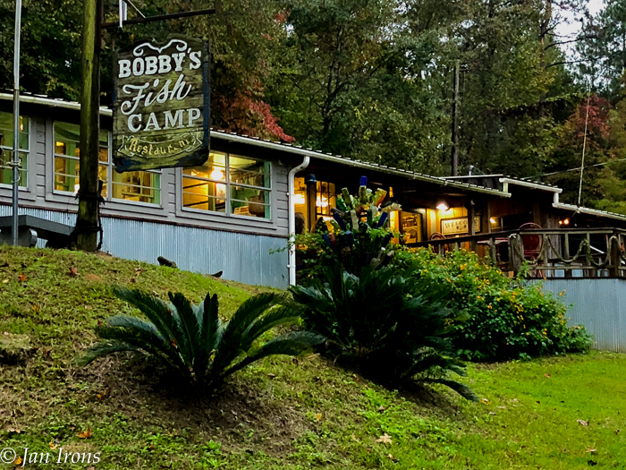
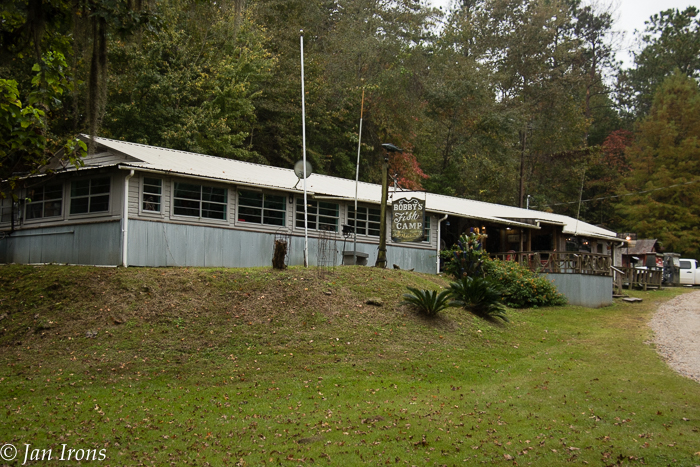
Few to no marinas. Below Demopolis for 200 miles the waterway is a meandering river in a a beautiful but challenging wilderness with only Bobby’s Fish Camp to break up the transit. Few if any would call Bobby’s Fish Camp a “marina” although it was a delightful iconic stop.
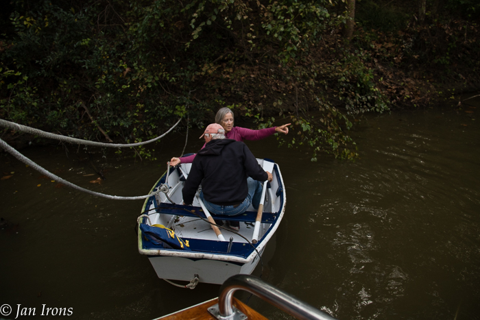
We had never “rafted” before this Great Loop adventure. We anchored a lot, over 150 days consecutively one year, but never rafted. So we learned something new. We rafted at Bashi Creek – needing to keep the boat in the middle of the tight creek, we dropped our anchor and backed it down. Then our rafting friends turned around, dropped their anchor down the opposite way and backed the boats together. This way we had the advantage of two anchors without any possibility of the rodes twisting together. This technique worked well.
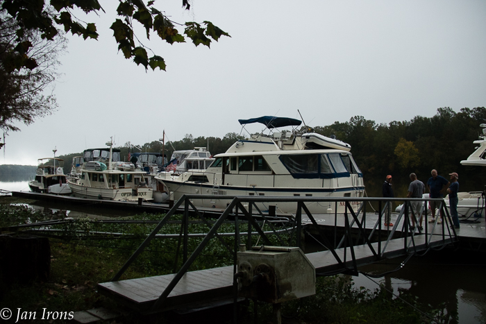
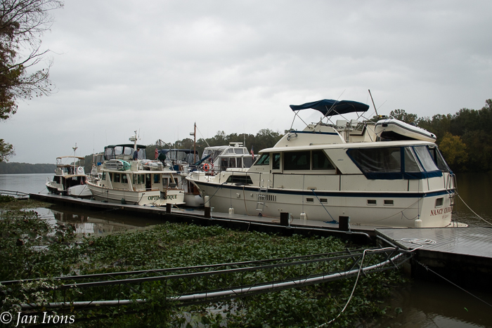
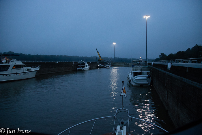
At Bobby’s, space for 4 boats on the dock needed to hold 11 boats. So we rafted boats together, 4 deep on our boat and the boat in front of us. All the boats turned up into the current to dock and raft, keeping all our bows into the current. It worked well, although a couple times a tow/barge came through the boats were jostling considerably. One of the secrets is tying the boats as tightly together with lots of fenders as possible.
The Route
Demopolis to Bashi Creek 70 miles. We left Demopolis Yacht Basin (Kingfisher) just after sunrise (and a severe line of thunderstorms) to get through the Demopolis Lock. Demopolis to Bashi Creek was a LONG run for us – but the early departure assured we had a couple of hours of daylight to get anchored and come up with a contingency plan if necessary.
The creek was much narrower than anticipated with overhanging trees. But we managed to get 6 boats (size 34′ – 40′ with 3 1/2 – 4′ drafts) anchored in a spot where conventional wisdom says 4 boats. One shallow draft boat went far up the creek, 3 rafted directly in front of us and we were 2 rafted nearer the entrance. In retrospect, 2 more boats probably could have rafted between us and the boat ramp at the entrance.
Bashi Creek to Bobby’s Fish Camp 26 miles. An easy run except for the rain and storms. Bobby’s was pretty soggy, but we managed to raft 11 boats to a dock that fits 3 boats, 4 toward the end of the day when they don’t need the fuel dock any more.
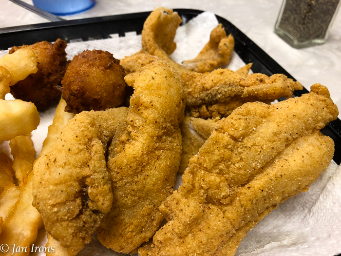
Bobby’s Fish Camp is only open Thursday – Sunday at this time. We heard if you know there will be several boats and you call and give them advance notice, sometimes they’ll open the restaurant. So we got to enjoy the ambiance and the fresh fried catfish that mades Bobby’s Fish Camp an iconic stop along the Great Loop.
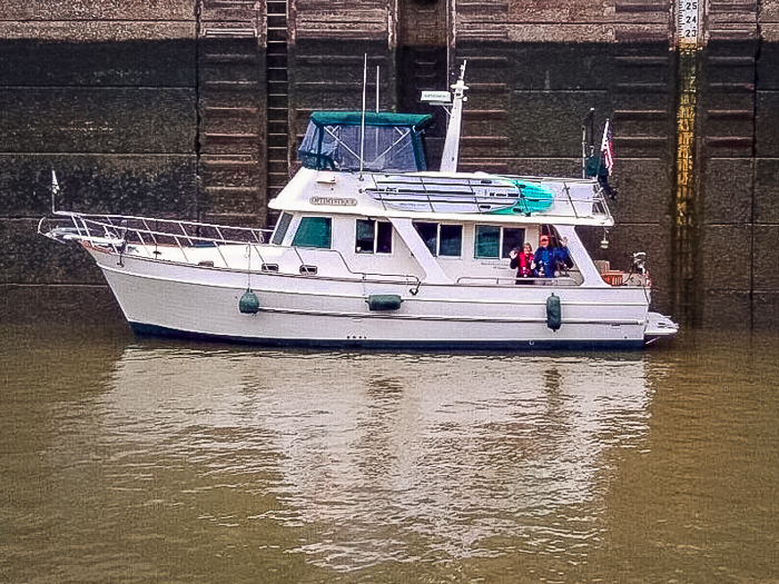
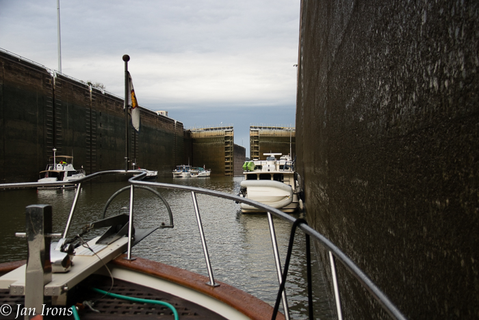
Bobby’s Fish Camp to Tensaw River Anchorage at Mile Marker 39.5. 83 miles. Yes 83 miles in one day! We called the Coffeeville Lock at 5:30 (AM) and were in the lock at 6:15 to lock down. This was our 100th Lock and the LAST LOCK ON THE GREAT LOOP for Optimystique! Another milestone.
After the lock, to our joy, we discovered a significant current pushing us along. We had hoped to stop at the Alabama River Cut-Off and raft again, but passed it by 2 PM in the POURING rain accompanied by thunder and lightning. GPS said we could make it to Tensaw River by 3:30, so we continued.
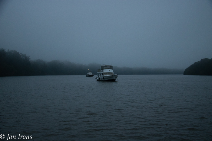
Tensaw River had the advantage of being large enough for all 5 of the boats still together so no rafting was necessary. The only disadvantage was anchoring on the north bank for wind protection meant deeper water than we would have preferred. We turned into the current and dropped anchor in 18′ just downstream of a tiny stream. Great holding and a relaxing night despite the fog that enveloped us just after anchoring.
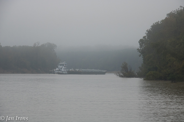
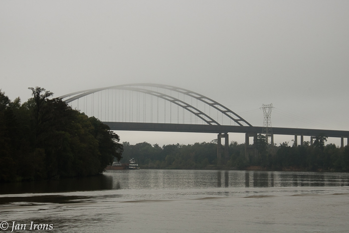
Tensaw River to Mobile, Dog River Marina. 53 miles. 53 miles and predicted increasing winds on Mobile Bay meant we needed to leave EARLY … when we woke at 6 AM, the fog still swirled around us. But luckily by 6:30 it started to lift and we were able to up anchor and depart. No locks, some hairpin turns, a lot of tows/barges and more giant almost submerged logs made this a less easy run than the day before, but still relatively simple. Getting to Mile Marker 0 at the I-65 bridge was yet another milestone.
Mobile’s busy harbor was fascinating and all of us enjoyed watching all the tow, ship, Coast Guard and tugboat traffic as we cruised through Mobile to Dog River.
TIP: We called TowBoat US asking if we could cut off and not go all the way below Dog River then turning North to get in the Dog River Channel. The TowBoat US Captain Billy gave us the information we needed to cut off a few miles and we arrived at Dog River Marina just before the predicted wind and storms! WIN WIN! If you look at your charts and think you see a cutoff for boats drawing less than 4′, call TowBoat US and ask for local information. It worked for us.
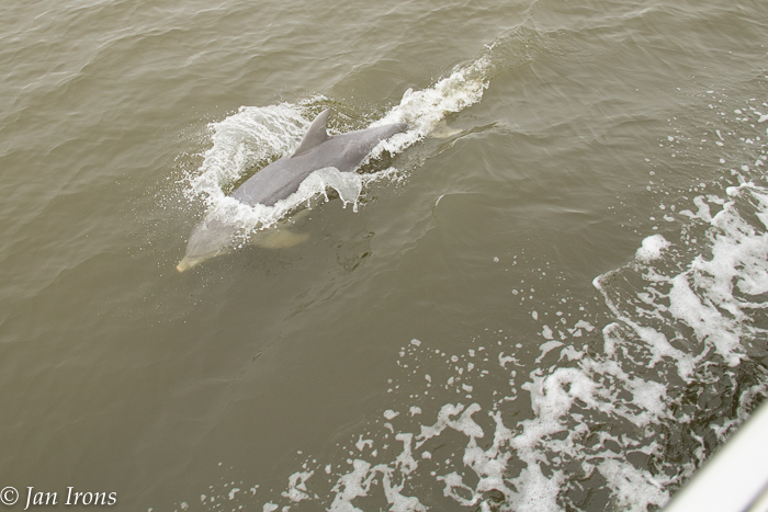
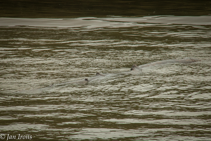
The dolphins were glad to see us back in salt water and accompanied us down the channel! What a great feeling!!!
Do you have different anchorages or stops between Demopolis to Mobile? Please leave a comment and share. Cheers! Jan


You make the Great Loop sound so inviting! One day…