
October 10, 2018, Hurricane Michael, the first Category 4 hurricane in history devastated the Gulf Coast.
Now, almost 6 weeks later, the time has come to see how Hurricane Michael impacted to the Gulf ICW…
Hurricane Michael Gulf ICW Summary: 6 Weeks Later …
- The last available pumpout for us was The Wharf in Orange Beach. Niceville’s Bluewater Bay, PCB Lighthouse Marina, Apalachicola Scipio Creek Marina and Carabelle did not have functioning pumpouts when we were there (3rd week in November 2018).
- Fuel is available at The Wharf, Bluewater Bay, Lighthouse, Scipio Creek & Moorings.
- Water was available everywhere except Lighthouse PCB – it had water, but not potable.
- ICW markers all appeared to be back in place.
- No debris in the channel with the exception of Lake Wimico just before Apalachicola – large trees floating and deadheads, but easily spotted.
These photos start at Ft Walton Beach, where we started seeing some residual impact and continue through Panama City, Mexico Beach and on to Apalachicola. Cruising through this area is a sobering reminder of the power of Mother Nature and Mother Ocean.
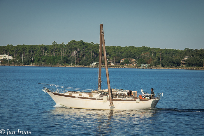
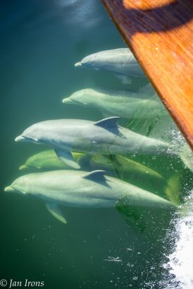
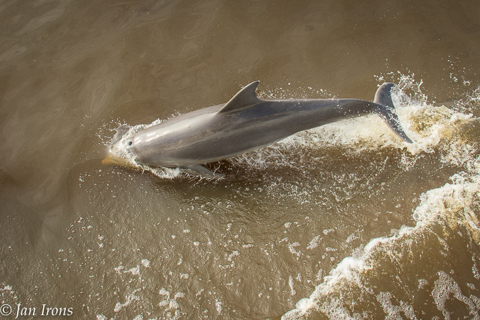
Starting in Ft Walton Beach, we started seeing some indications that things ahead may not be as they used to be … notice that here, most of the trees still have foliage. At the same time, we were reminded that Mother Nature has a way of recovering with dolphins leading across this section of The Great Loop.
Very few marinas are open, a few that are “open” are just a dock to park at for the night, no services, no electricity, … Because there are so few marinas that still have docks, area boats have by necessity relocated to the few that remain, making transient slips almost impossible.
Fuel is still an issue, but we did fine fueling up at The Wharf in Orange Beach, AL, then topping off at Bluewater Marina in Niceville, FL and finally refueling in Apalachicola.
In Ft Walton Beach/Niceville, a few marinas are open – we were put on a waiting list and then called back for a slip. Bluewater Bay Marina in Niceville has fuel and all facilities, but is extremely busy with very few transient slips – we might have been the only transient Loopers.
Leaving Niceville, headed east along the ICW, the next day takes us closer to Panama City. We started seeing more signs of a hurricane zone, but still not overly so.
There were SO many dolphins on this 63 miles (Niceville to Shell Island) and also SUCH muddy water! Prior to now the water had been clear bluegreen or clear iced tea colors, not muddy Mississippi, but heading from Ft. Walton to Panama City, it was MUDDY!
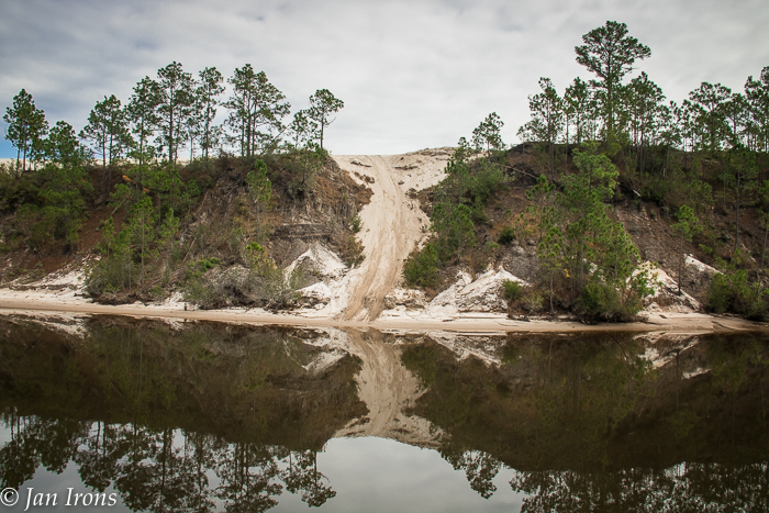
The ICW goes from almost open water into a canal lined with trees and high banks, turning into sand banks. Trees were uprooted from the banks, but still had their foliage and most things looked normal even 30 miles west of Panama City.
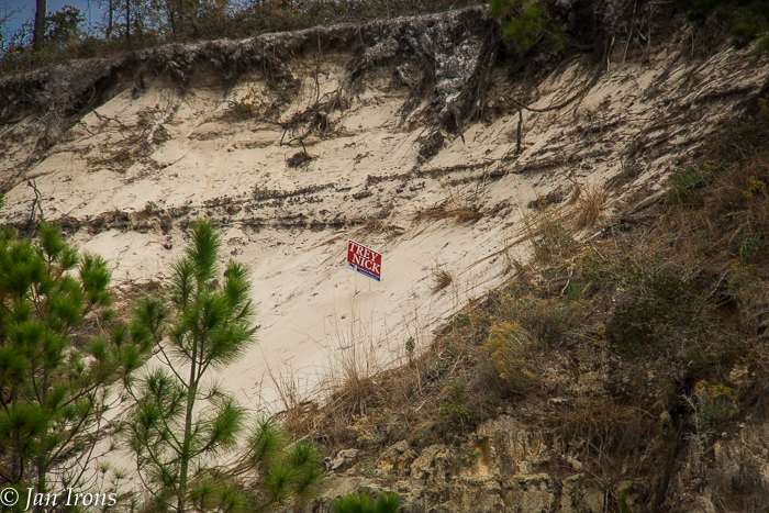
That election just won’t GO AWAY!!! Election signs were blown into some of the most remote places.
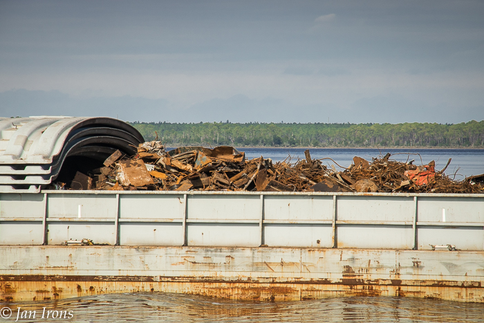
Barges are being used to transport hurricane debris out of the Panama City area.
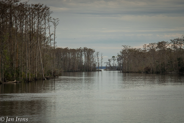
As we crossed open water stretches of the ICW, we could forget there was any hurricane.
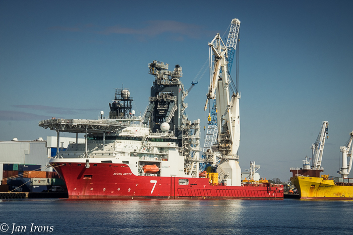
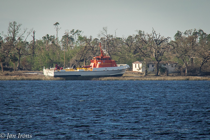
Shipping into Panama City seems normal with several ships in port, loading and unloading cargo.
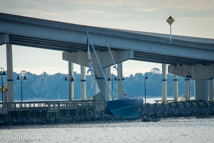
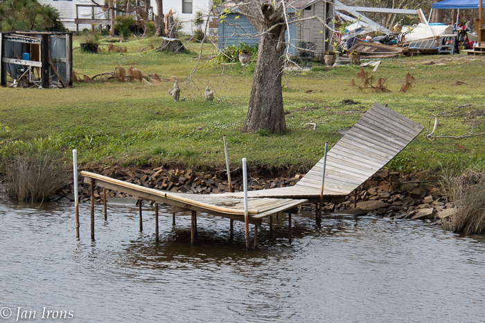
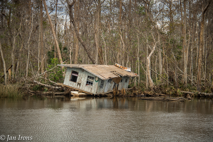
Approaching Panama City Beach, everything changed. The marinas had mostly been destroyed but we were able to find Lighthouse Marina who promised us nothing but a place to tie up and enjoy Thanksgiving with other Looper boats.
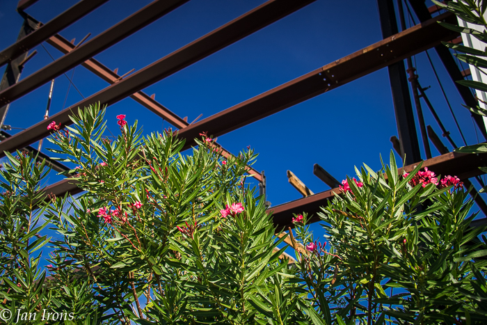
Arriving at Lighthouse Marina, we were surprised to find electricity and fuel available. No potable water, showers or restrooms, but the restaurant was open and delicious. Ronnie at the marina told us he stayed 3 blocks from the marina during the hurricane and could have just as easily been killed as been standing in front of us. He was clearly rattled and said he would NEVER stay in the future. Walking around the marina area was an illustration of contrast – here the back quarter of the dry storage building is ripped to beams while landscaping is still intact and flowers bloom next to the decimated wall.
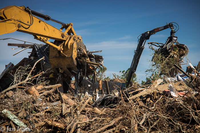
Across the street from the marina, FEMA has a debris removal facility. Here trucks haul in debris of all sorts that’s been picked up along the streets where it’s piled, sometimes several stories high. It seems to be sorted with mixed debris being loaded in semi truck after semi truck to be hauled away. The trees are loaded into the biggest shredder we’ve ever seen and chipped into mulch to be hauled to the paper plant and north for mulch.
Some of the debris piles have interesting stories …. all sad….
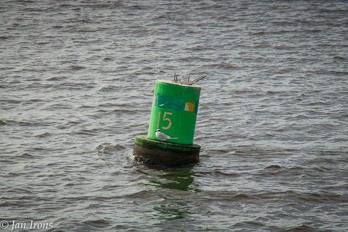
Leaving Panama City Beach, heading east, we were amazed that all the ICW markers were in place – although some had clearly been replaced by the US Coast Guard after the hurricane. ICW Marker #15 lost ….
And replaced ….
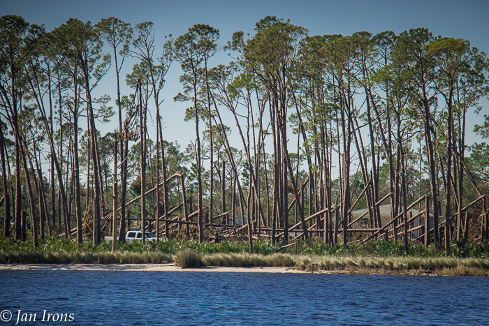
After Panama City Beach, trees were snapped like matchsticks, uprooted, boats tossed like matchbox toys and mayhem reined. But reconstruction was underway …
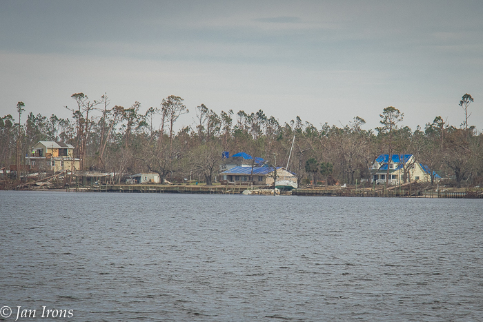
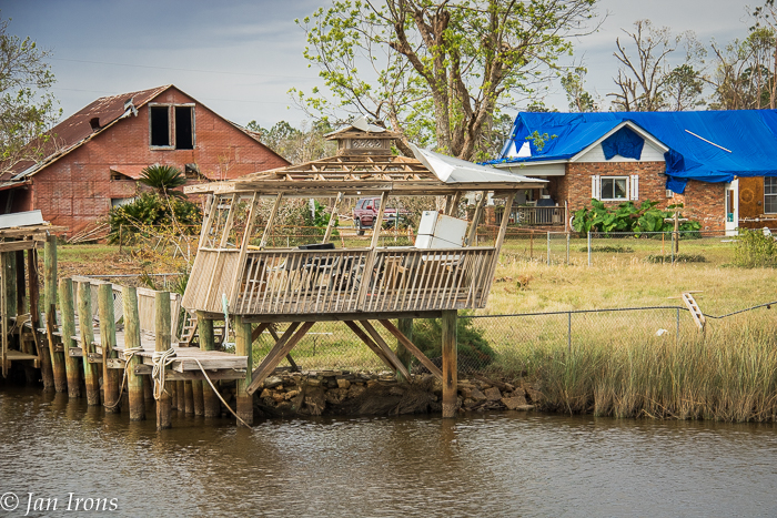
Almost all houses and buildings had blue roofs – the blue tarp industry must be booming!
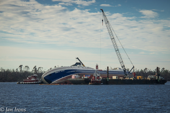
North Star, a 261 foot Alaskan fishing vessel was almost finished with construction when Hurricane Michael flung her across East Bay. Recovery efforts are underway.
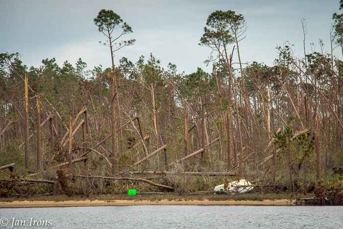
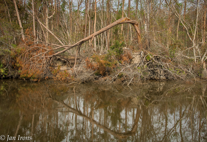
As we approached directly north of Mexico Beach, the devastation became worse. The ICW meanders through swamp, not much habitation, but what there was was clearly affected.
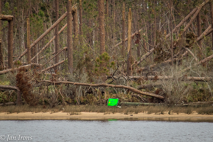
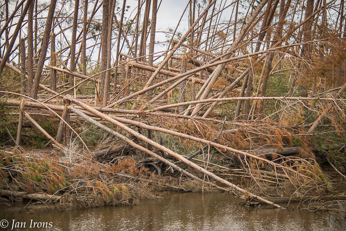
I have never seen so many big trees just snapped, or uprooted … Between Panama City and Mexico Beach, there was still foliage on some trees, a touch of green. After Mexico Beach, the swamp turned monotone … no foliage, nothing …
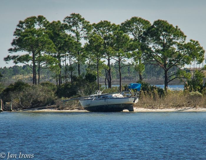
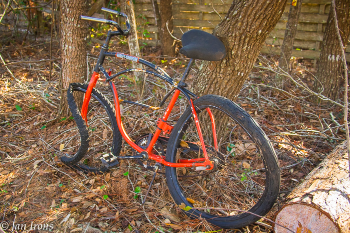
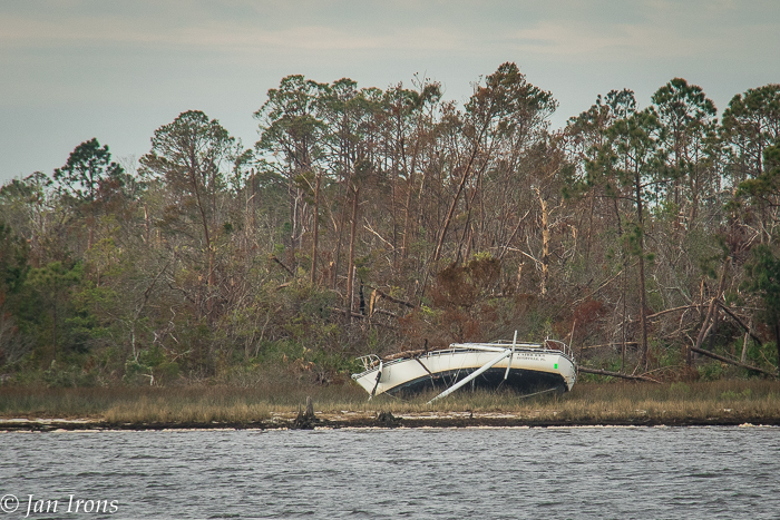
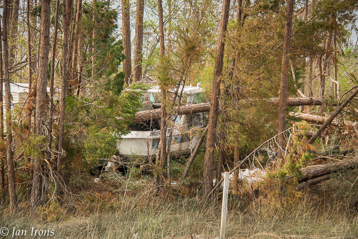
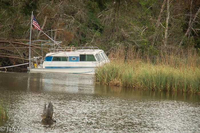
Boats tossed here and there all along …
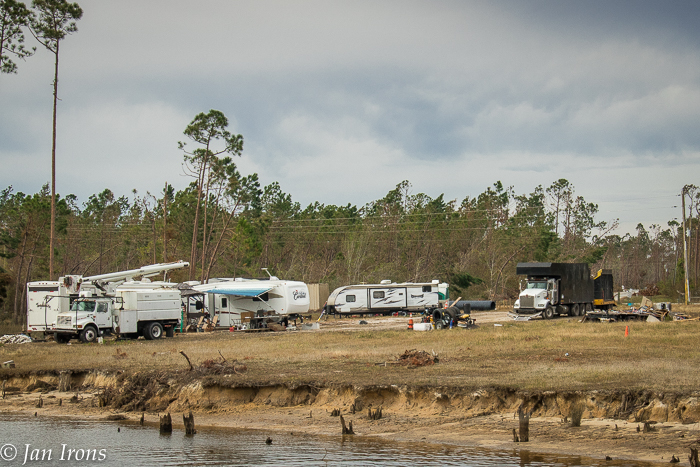
We were told that FEMA is using regular RV trailers after Hurricane Michael. With the FEMA trucks, this looks like a base camp along the way. The black truck is the type that has a “claw” to pick up debris along roadways and then transport it to the FEMA debris facility across from Lighthouse Marina.
Wind and water …
Close by was a boat crushed by a tree…
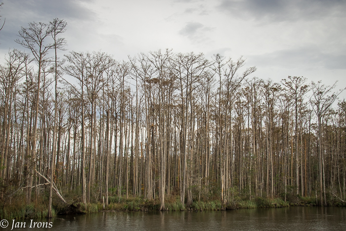
And then the landscape turned totally monotone, no foliage on any of the cypress trees.
Heading away from the area where almost every tree was snapped, trees were now uprooted and fewer trees snapped.
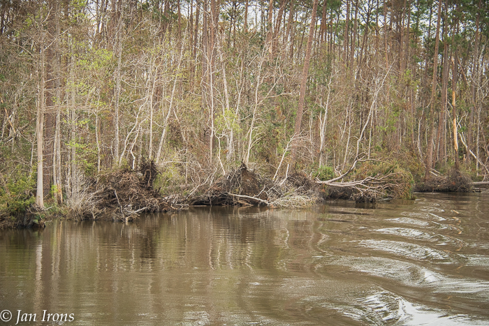
More monochrome … headed into Lake Wimoco, just before the Apalachicola River.
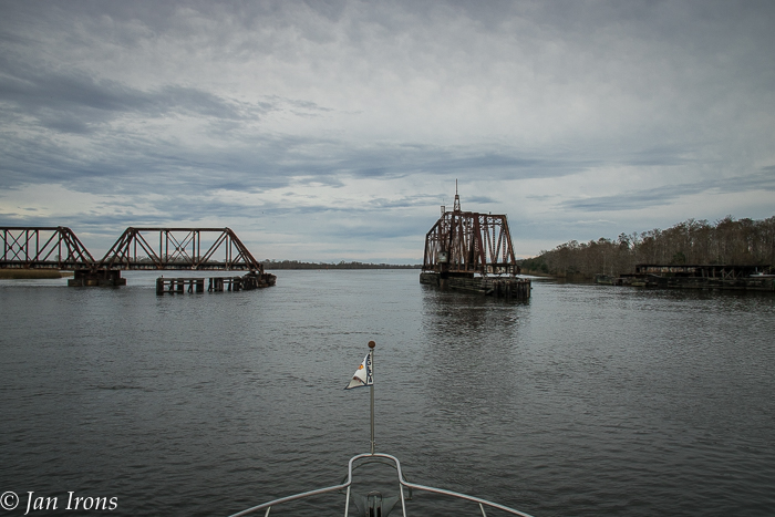
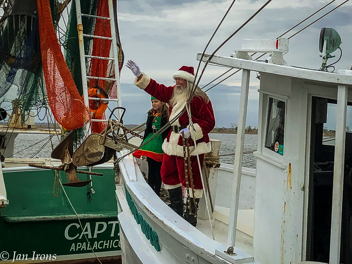
Close to the end, this permanently closed/always open railroad bridge welcomed us to Apalachicola. Where we were lucky to find space at Scipio Creek Marina … fuel, electricity, a great restaurant, showers, laundry … Scipio Creek has it all AND, is in easy walking distance to “downtown” funky Apalachicola … where we watched Santa arrive via a shrimp boat…
HELLO Santa! After Thanksgiving, it’s Christmas Season! I’m sure everyone in Apalachicola is happy for a return to some normalcy in their lives after Hurricane Michael!
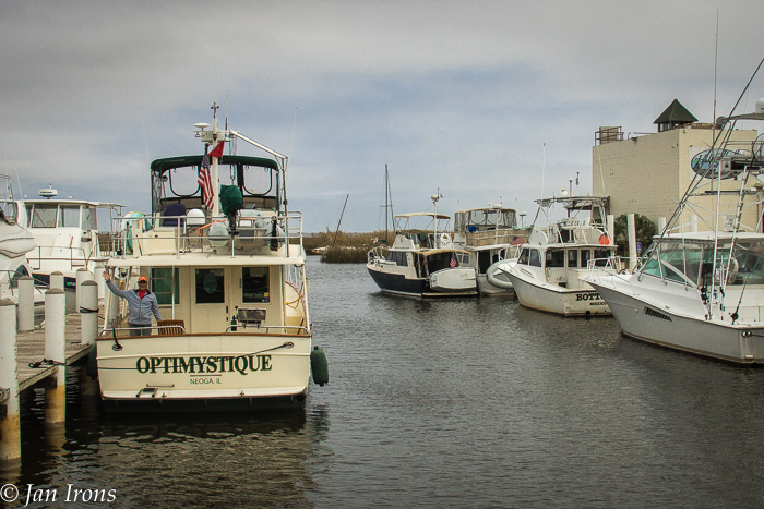
Cheers from Optimystique! Jan & David


incredible commentary and visual carnage…blessings to those that have lost and those that lost it all! safe travels to you guys…looking forward to your winter exploits!
s
Thanks Scott! J
Loved the pics. It’s nice to know where we are headed.
Mark and Lezlie on Antonia
Texas Trawler Trash on Facebook
Excellent images Jan
Thanks John! HI to Ellen!
JAN,
So happy you are safe and moving along. I appreciate the great pictures and commentary about the state of things on the Gulf after Michael.
Hugs,
Susan