One of the first lessons we learned about weather was to watch out for the strong HI that fills in immediately behind a LO pressure system, cold front or norther, whatever you prefer to call it.
Our first overnight passage aboard Winterlude was from Cape Fear Inlet, NC outside to Charleston, SC — luckily our friends, Dave & Carolyn Shearlock, of TheBoatGalley.com fame — were with us. We waited for weather and after the “bad weather” went through, we figured we were good to go south. We were all looking forward to getting as far south as we could in the 10 day window we had (we were all still working then). Unfortunately, what we DIDN’T have a clue about is if there’s a strong HI behind the LO, often the wind can be stronger than forecast.
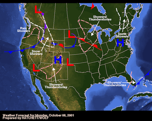
Here’s NOAA’s surface analysis from October 6, 2001 — the day before we were departing, showing the lousy weather. The next day, see surface analysis below October 6, you can see the storms cleared out & there was nothing that looked scary in this surface analysis. So we left Cape Fear Inlet.
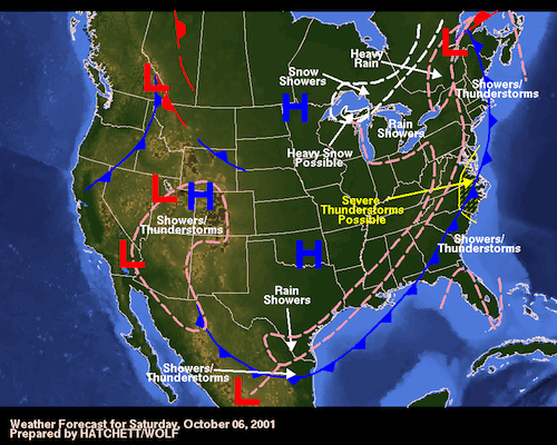
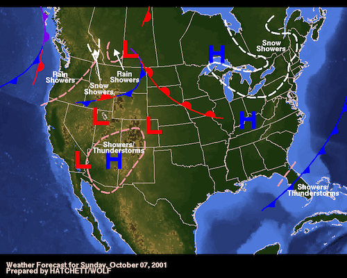
Imagine our surprise to suddenly overnight between Oct 7 & 8 to have the winds & seas increase to just under gale force — Force 7, blowing 35 & what seemed to us to look like GIANT waves that absolutely must be going to crash over the stern and into the cockpit. And at the same time brilliant GORGEOUS sunny day. It’s not supposed to be so windy on such a brilliantly beautiful day!
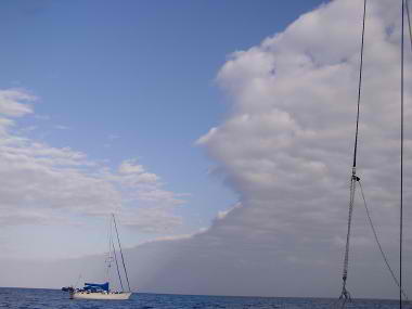
Photos never seem to show the trauma — the wind blowing the tops of the waves into spray, the giant sets of 3 waves that tower above the stern, but David’s face shows a bit of the trauma the following morning when we looked for the closest inlet we could get in and get OUT of this wind.
 Luckily sailing weather forecasting has come a long way since 2001 and we can use WindFinder, Buoyweather or Chris Parker if it’s in one of his coverage areas for more specific forecasting. Most of the professionals recognize that a strong HI behind a LO may increase the pressure gradient to the point that the wind is stronger after the storm when all indications look like it should be a beautiful sunny day. The next day, October 8, shows that innocent HI sitting closer to the east coast.
So watch out for a strong HI following a LO pressure system. The pressure gradient may be stronger than normal. We’ve seen it happen many times since and have been surprised many times. But finally we recognize the possibility and are on the watch for it.
 If you want to learn more about weather systems, a good (although somewhat technical) book on the subject is “Weather Predicting Simplified”. And you can get it at Amazon by clicking the link.
Anyone with more experience and input on this subject, please leave a comment and share with the rest of us! THANKS! Jan
