Weather will always be a challenge but understanding three factors may make it easier. When we first started cruising, we could never understand why when the wind was forecast to be east at 10, was it blowing 20? We also didn’t understand wave forecasts – if the forecast is for 3-5 why are we getting bobbed around by 8 foot waves from every direction? And why, even though we keep reading that the wind dies at night, does it always pipe up at midnight?
It’s not always because the weather forecast is wrong, believe it or not! Weather forecasting is based on “large scale” weather patterns. This means that when you’re sailing from the Rio Dulce, Guatemala to Placencia, Belize, the weather outside may look nothing like what the weather forecast says.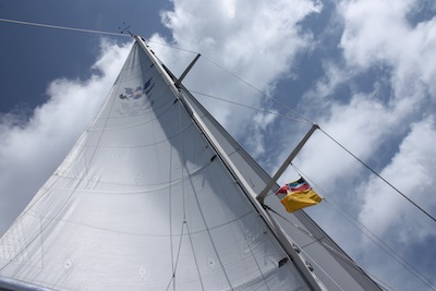
Three other factors also influence local weather patterns – unfortunately for us, we learned about some of these on our way HOME from six years cruising the Western Caribbean! 🙂 Larry on sv Moira put on a terrific weather seminar in Isla Mujeres, Mexico where we learned some tidbits we had previously overlooked. If you’d like to see the entire weather class downloadable PDF, visit sv Moira’s website by clicking here. And if you get a chance to go to Larry’s weather seminar aboard sv Moira, by all means take advantage of the opportunity!
Winds forecast by the NWS or NOAA are based on large weather features, primarily high or low pressure systems and fronts (cold, warm, stationary and occluded). The actual winds and weather you will experience while sailing will be influenced by many factors, three are discussed below, but you should always be aware that the forecast winds may be 50% stronger in gusts. So for a forecast of 15-20 knots, you should anticipate gusts could be as high as 30 knots. Of course, weather answers to no authority and it could just as easily be blowing 7 knots. This general statement will hold true for winds offshore (outside of at least 20 miles). Nearshore winds are influenced by these factors …
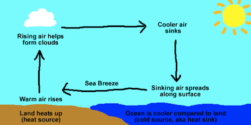
Sea Breeze. Sea breeze is familiar to most people including us, but what we never realized was how to interpret the NOAA wind forecast with the sea breeze included! Sea breeze results from the heating of land masses during the day and cooling at night – this causes wind to blow onshore during the day and offshore at night – typically the greater the temperature gradient, the stronger the sea breezes. And you have to add or subtract the sea breeze from the NOAA wind forecast.
Morning wind can seem lighter than offshore because the wind is offset by the breeze blowing onshore – moving from the warmer water to the cooler land. Up to 20 miles offshore, you need to add the offshore wind to the forecast wind. So, if there’s a 10 knot wind predicted and the sea breeze is 5 knots, you may see winds at 15 knots until you’re out of range affected by land, generally at least 20 miles. When we left Isla Mujeres, the forecast was for 12 knots, but we had over 20 knots until we were beyond 20 miles from land. It was reassuring to finally know WHY and we know that the wind should drop back to the forecast 12 knots after we were beyond the effect of the sea breeze.
Also, if you’re near the shore in an onshore wind, the wind will become more parallel to the coast. This happened to us off the coast of Honduras when sailing from Providencia, Columbia to Roatan, Bay Islands, Honduras. The wind was on the nose (NE) the entire trip up to where we rounded the corner to sail almost due west to Roatan. Unfortunately, we didn’t realize that the early morning wind was going to parallel the coast, meaning instead of a nice broad reach to Roatan, once again we had winds almost on the nose due to the tendency to parallel the coast.
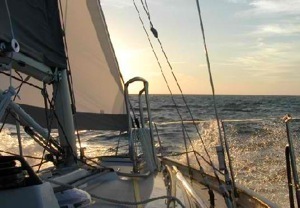
Night Winds. I can find no scientific or meteorological explanation for our experience with night wind. At midnight invariably something happens to the wind – typically it gets stronger, although this is not logical or consistent with sea breeze/diurnal winds. At night as everything cools, the wind, especially within 20 miles of the coast, should be lighter. But not on sv Winterlude. I can count on three fingers how many night passages we’ve had where the wind actually decreased overnight. Mostly it increases, sometimes dramatically and gets lighter just before dawn. Consequently, we almost always put in one more reef in the mainsail just before sunset. If we’re pleasantly surprised and see no increase in wind, we can either shake out the reef easily or sail a bit slower, making it easier to sleep below while off watch.
Local Features. Local features, primarily geography, will often have an impact on the weather. Large weather features such as cold fronts, warm fronts happen over a huge geographic area. But locally, they are influenced and changed by local geography such as hills, valleys, large bodies of water etc. You’re probably aware that coastal areas have warmer temperatures than inland – this is because the coastal waters have a moderating influence. In hilly areas, hot air moves up the hills during the day and down the slopes at night – in addition, if the hills are steep, the night wind can be funneled and directed in different direction and intensities than the winds outside of the hilly influence – so if you’re anchored surrounded by big hills or mountains, there may be stronger winds at night coming in gusts funneled through the hills in different directions.
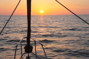 If you happen to be sailing near a coastline with high bluffs or mountains, you may experience weird gusts that are entirely caused by the geography of the land features. Some of the best books we’ve seen explaining how to take advantage of these land weather effects is Bruce VanSant’s “Gentleman’s Passages South” or “Tricks of the Trades” – click here to buy the books on Amazon – Amazon will give CC a small amount, you’ll help support Commuter Cruiser and it won’t cost you an extra dime.
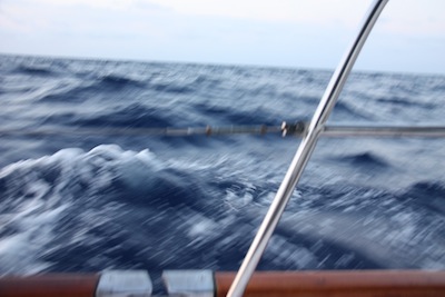
And let’s not forget… Wave Forecasts. It’s also important to note that in NOAA forecasts, the range of wave heights given are not inclusive of the “outliers” – the individual waves that may be twice as high as the forecast height. Thus, if the waves are forecast to be 3-6 feet, you could easily see individual waves of 12 feet! Don’t neglect the “wave interval” you would prefer to have the wave interval be a larger number than the largest of the wave range – for example, if the forecast is for wave heights of 3-6 feet, you would really like to have the interval be at least 6 seconds and preferably more, to avoid the washing machine effect. Also, keep in mind, if the wind is against the waves – which happens anywhere there’s strong current, such as going in or out of a river entrance or in the gulf stream – wind against the waves will make the waves much steeper and larger than forecast in that specific spot. So anywhere there’s current beware!
So don’t despair if the weather doesn’t match the forecast, learn as much as you can about other factors affecting your cruising ground and you will be much better prepared than the average cruiser! Do you know more tricks with weather? Leave a comment and let us know! Cheers! Jan


Great post! Beginners like us find this to be very valuable information … thanks!
Another one is the position of a hurricane/trop storm/depression is the CENTER! You’ll feel the effects quite a ways away and long before the “position” is over you. Very important in considering how much time you have left to prepare for the storm!
Say…
I know this is an older post, but I just found it – and am confused.
Paragraph 5 says that “heating of land masses during the day and cooling at night – this causes wind to blow onshore at night and offshore during the day” – but isn’t that backwards? I thought the heating of land during the day creates rising air over the land, which brings on a sea breeze after noon. Then during the night the land cools, causes the air over it to cool and drop and creates the land breeze.
Or did I miss something?
No you didn’t miss anything Keith – thanks – sometimes I think I’m dyslexic, I get my words twisted. I can’t believe no one’s noticed before now. THANKS! I corrected the sentence. Cheers & THANKS! Jan
My pleasure! Being a frequent contributor to the “well that was backwards” club myself, i completely get it!
Now, with our two feet of snow and two inches of ice… can we come visit, please? We dont snore, and we like to cook and do dishes… 😉